UN Resolution Adopts Equal Earth Map to Correct Scale of Africa
Quick Brief
The United Nations has passed a resolution to phase out the traditional Mercator world map in favor of a projection that accurately reflects global landmass proportions. Brought to the assembly by Togo, the change highlights the true scale of territories, particularly Africa, which appears significantly larger than on the legacy map. The shift addresses long-standing concerns regarding geographic representation and global perceptions of power.
What Happened?
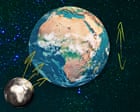
The UN general assembly passed a resolution brought by Togo this month to replace the traditional Mercator map with the "Equal Earth" map. The new projection shows the true proportions of global territories, addressing the historical distortion of the Mercator map which made northern hemisphere landmasses appear much larger and diminished the perceived scale of Africa.
Why It Matters
Standard global maps have long influenced perceptions of land, power, and influence by disproportionately shrinking tropical regions and expanding northern areas. Correcting these visual proportions challenges decades of geographic conditioning and acknowledges the genuine geographic scale of African nations.
Key Facts
- The UN passed a resolution this month to phase out the traditional Mercator map.
- The initiative to replace the map was brought to the assembly by Togo.
- The new map being adopted is known as the "Equal Earth" projection.
- Africa is the primary beneficiary of the scale correction, revealing its true proportions.
- The legacy Mercator map made the northern hemisphere appear much larger than it actually is.
Compiled from 1 outlet
Related Stories

Ukrainian Drone Strikes Impact Major Russian Diesel Refineries
Recent drone strikes launched by Ukraine have forced three of Russia's largest diesel refineries to either suspend operations or substantially cut their production output. The military actions target key energy infrastructure within Russia.

Israeli Directors of Gaza Documentary NAZA Face Escalating Threats
The Oscar-winning Israeli directors of the documentary NAZA are facing mounting threats from government ministers, the military, and far-right activists. Produced by the Guardian, the film explores civilian casualties in Gaza and builds on previous investigative reporting. In response, dozens of local human rights organizations have rallied in support of the filmmakers.
Global Photography Selection Highlights Protests and Cultural Events
Picture editors have released a daily curated selection of photographs from various locations around the globe. The featured images capture diverse scenes, including a protest by fishers and a dove singing competition. These visual roundups provide a glimpse into international current events and daily life.

German State Leaders Back Chancellor Friedrich Merz Amid Rising Political Pressures
Powerful state leaders within Friedrich Merz's party have voiced their support for the German chancellor amid growing speculation about his political future. The show of unity follows a major regional election defeat earlier this month where the far-right Alternative für Deutschland party outperformed the chancellor's Christian Democratic Union.